

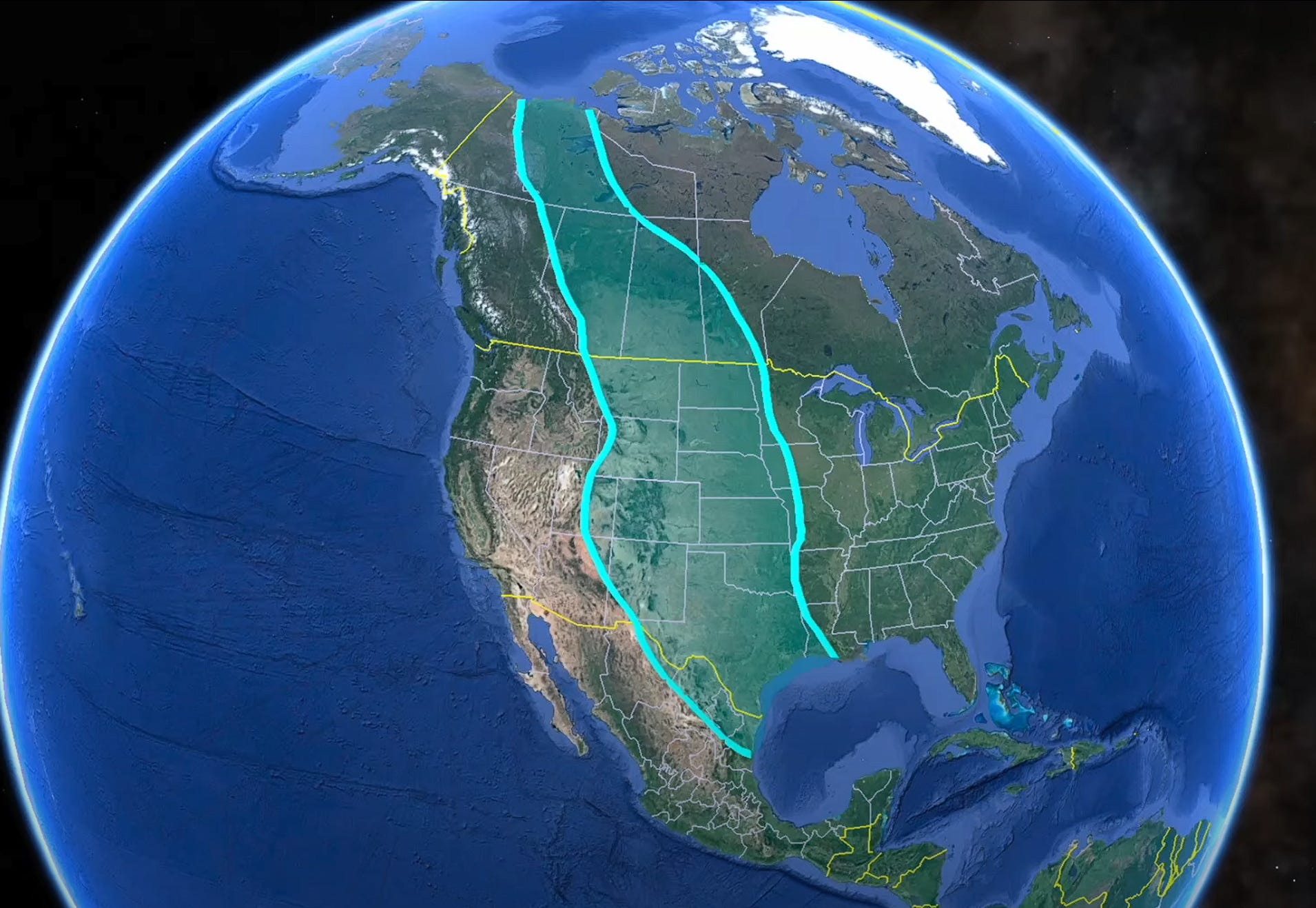
#youtubepick How Geologists Discovered and Mapped a Great Seaway
Cretaceous Interior Seaway, Utah geology ...

Geology Rocks.
- 🌍 Exploration of a great Seaway that divided North America for millions of years.
- 🌊 Understanding the geological processes that led to the formation and disappearance of the Seaway.
- 🏞️ Importance of studying ancient landscapes and rock formations to unravel Earth's geological history.
- 🛠️ Techniques used by geologists to map ancient oceans and lakes, including drilling and studying sediment layers.
- 🌋 Use of volcanic ash layers and fossils like ammonites to date and correlate rock formations.
- 🏞️ Examination of shale deposits in Utah and Wyoming, showcasing the vastness of the Seaway.
- 🌍 Utilization of well data and geological tools to create a comprehensive picture of underground formations.
- 🌍 Connection between the Seaway's deposits and various natural phenomena like Sandstone formations and coal deposits.
- 🌊 The video discusses the geological processes involved in the formation and filling of the Cretaceous Seaway over a period of 40 million years.
- 🏖️ Sedimentation within the Seaway varied, with clay-sized particles settling far from the shoreline and larger particles like sand closer to the coast.
- 🏞️ Beach deposits shifted over time, moving eastward as the Seaway filled in and the basin subsided, eventually getting buried under more sediment.
- 🌄 The uppermost thick Sandstone layers, such as the Mesa verie formation, marked the final stages of Seaway filling and are associated with coastal environments.
- 🛠️ The video also touches on structural observations in Wyoming, including steeply tilted beds, sandstone pillars, and cross-bedding indicative of energetic currents.
- 🏜️ Differential erosion reveals sandstone bodies encased in mudstone, suggesting coastal plain environments and distributary channels common in deltaic settings.
- 💧 The presence of coal and small distributary channels away from mountains further supports the interpretation of a coastal plain and deltaic landscape.
- 🌅 Reflecting on the time scales involved in deposition, burial, and erosion of shale layers provides insight into the long-term geological processes shaping the region.